Know the ground. Go farther with a clearer picture.
Detailed maps, offline regions, trip recording and practical machine learning for the US and Canada. Bristlecone learns your stride, helps surface useful trail reports, and brings terrain and mountain conditions into one place.
Find a route, understand its demands, pack the map and keep a record of the day. The details stay close without crowding the view.
01
Read the landscape.
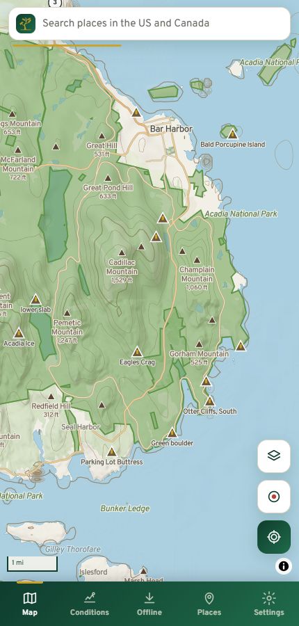
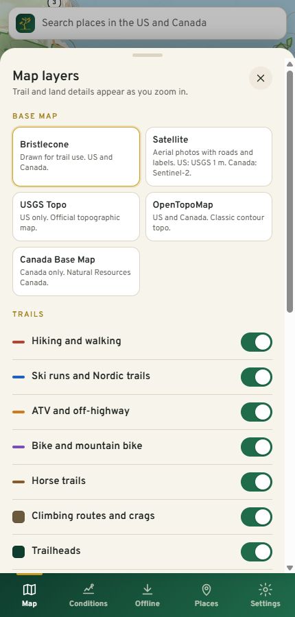
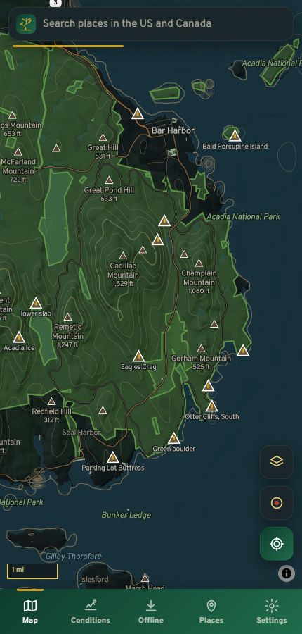
Switch between trail, satellite and topographic maps. Contours, hillshade and optional 3D terrain reveal the shape of the ground. Choose hiking, cycling, ski, horse, ATV/OHV and climbing layers, with public, protected and Indigenous land boundaries for context.
02
Plan with the details.
Explore route length, climb, high points, steep grades and an elevation profile. Difficulty ratings explain the terrain and effort behind them. Trailhead cards bring together directions, nearby parking, descriptions and credited photos where sources provide them.
03
Take the map with you.
Download a region’s trail map, terrain and land boundaries before leaving reception, with the option to include your selected base map. Available hazard layers are included; recently fetched reports may also remain in the browsing cache. Check that your region download is complete before heading out, and check report dates and saved-copy notices when viewing conditions offline.
04
Record your kind of day.
Track hikes, walks, runs, rides, ski tours, paddles and more, including recording with the screen locked. See distance, moving time, climb and supported activity metrics. Only walks and hikes train the stride model; step-based position estimates are for travel on foot.
05
Keep the story of the trip.
Search activity history, add notes, compare totals, inspect profiles and splits, or replay a route. Share a map-and-stats card or export GPX through your phone. Shared routes hide the first and last 200 metres by default, with adjustable privacy distances.
06
See what has changed.
Check official weather, alerts, park closures, avalanche information and wildfire perimeters alongside trail reports. Reports are grouped by age and sorted newest first. Source availability varies; the app identifies the information it can retrieve.
Small models. Useful work outside.
Krummholz is an AI company. In Bristlecone, that means using machine learning for specific problems you encounter on a trail, and being clear about what each model does.
On-device machine learning
A step model that learns your stride.
During clean GPS walks and hikes, the phone learns how your step length changes with cadence and climbing. If GPS becomes unreliable, that personal ML model helps estimate movement from your last trustworthy fix using steps, compass direction and available sensors.
GPS-less tracking is an estimate, shown in amber with an expanding uncertainty circle. It cannot find a position from nowhere, and it asks you to check against landmarks as uncertainty grows.
On-device machine learning
A better signal in trail reports.
A trained classifier looks for first-hand condition reports in public posts. Your Useful and Not a trail report feedback helps the filter learn on your own device, making it easier to find reports that matter to your day.
The model sorts information; it does not verify that a report is true. Dates, sources and official notices remain part of the picture.
On-device ML + elevation-aware weather
Conditions change as you climb.
The Mountain weather card combines public forecasts, nearby stations and terrain to estimate temperature, wind and gusts, freezing levels, and rain or snow when precipitation occurs, at your elevation and nearby high ground. Official forecasts stay alongside.
The current beta includes a trained temperature correction that runs on your device with the physical model. This preliminary pilot uses 187 time-matched observations from 31 US stations on one October day.
It applies only to October NWS inputs within narrow trained ranges, with terrain available and no overlapping station adjustment. Other seasons, Canada, larger elevation differences and unsupported conditions retain the physical model. Broader mountain conditions need validation. Read the results and full limits ↗
The stride model and report filter learn locally. The weather correction is trained before release and runs on your device. You do not need a cloud chatbot or a Bristlecone account to use these models. New maps, forecasts and public reports still need a connection to their sources.
Built around the way you get outside.
Keep personal records close.
Activity history, saved places and model personalization stay on your device by default. An optional device-authentication lock protects activities and saved places. You choose when to share a route or create a backup through your phone’s file picker, including Google Drive or iCloud Drive.
Optional Health Connect on Android 14+ and Apple Health integration can save supported workout information. Bristlecone writes those records with permission; it does not read your health history.
Make the view your own.
Use feet or metres, select the trail layers you need, and choose light, dark or automatic appearance based on local sunrise and sunset. Switch between US English, Canadian English, Canadian French and Spanish.
Backups can move between Android and iOS. Live map and weather requests contact their public providers, and sharing or cloud backup uses the services you choose. Offline downloads keep saved information available when those connections are gone.
A better look at the trail ahead.
I spend a lot of time on Maine’s trails. Bristlecone is the app
I’m building for those days: trail maps for the US and Canada,
offline downloads, hike recording, and a closer look at the
conditions ahead.
The current beta includes our first trained temperature correction
in the Mountain weather card. It learns from real station
observations and runs on your phone, within the limits of this
early pilot. We also fixed missing readings being treated as
zero and made uncertainty follow the age of the forecast.
These are model estimates, not measurements. Official forecasts
and alerts are right below them in the app, and your own eyes and
ears outrank all of it.
Still testing, still fixing things. If something breaks or feels
off,
let me know. Safe adventures. Hayven
Open source under MIT.
Bristlecone’s first-party application code and associated application documentation are available under the MIT License. You may use, copy, modify and distribute the software, including commercially, subject to retaining the license’s copyright and permission notices.
Third-party software, fonts, maps and source data retain their own licenses and notices. Dataset releases have separate source-specific terms; the app’s MIT license does not relicense them.
The MIT License includes an “as is” warranty disclaimer. Software permissions are separate from rights in the Krummholz AI name and branding.
Android 8.0 or newer. Open the APK on your phone and allow
installation when prompted. This is a test build; the future
Google Play version will need a fresh install.
Upgrading from 1.4.0 or 1.4.1? Those Android
builds used different test signing keys, so an in-place update
may fail. First export a backup to a private file you control
and confirm the file exists. If you choose to migrate, manually
uninstall the old app, install 1.4.2, then restore that backup.
Some native personalization may need to be learned again.
Starting with 1.4.2, release betas use a persistent signing key.
 krummholz